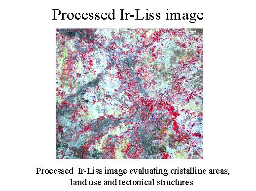
| This is a processed Ir-Liss image evaluating crystalline areas, land use and tectonical structures. You can easily see the main fractures from north-east to south-west and also the Nakkavagu basin following them from north, north-west to south, south-east. |
|