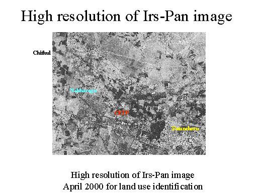
For the land use identification we elaborated an Irs-Pan image taken in April 2000. The image shows that the industrial and the settlement areas are growing up very fast.